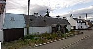
Village centre and views
The Gallery at the foot of the page contains a selection of images related to the Village. An alternative viewing can be had by down-loading this PowerPoint presentation.
The following pages were originally created whilst setting up the History of Culbokie website. However as further images of locations around the village become available we hope this is a more convenient page to display them in the Gallery and a wide selection is presented.
The Village Centre - historical background.
An tour through historic Culbokie. - street-level view of the Community based on properties that were recorded on the 1882 OS 25" to the mile map.
A Red Kite's eye view - aerial views of Culbokie.
Housing Developments - an index to the various developments around the Village.
 Click on this image to view a selection of interior and exterior photographs taken prior to demolition.
Greenhill Steading/Farmhouse - Greenleonachs. Selection photos relating to these properties. Photos courtesy of the Robb family.
Whilst searching the Highland Historic Environment Record (HER) database a variety of properties were recorded. These are included below as some contain photographs of the property prior to renovation/demolition. Most are outwith the immediate environs of the village.
Derelict cottage below Badrain lots of photographs prior to renovation.
Woodside prior to the Ferindonald development. Unfortunately the photographs require rotation before viewing.
Crochar - HER information only, no photographs. See below in Gallery.
Longhouse south-east of Dunvournie – interesting photographs.
Balloan farmstead - interesting collection of photographs.
Findon Mains - document only. Photograph at end of Gallery below.
Farmworkers cottages adjacent to New Urquhart cemetery. Layout only.
Gordon's Croft, Greenleonachs - photographs of farmstead buildings as part of a planning application.
Listed house at Drummondreach - not strictly Village but very interesting photographs of the existing property.
The story associated with the snow clearing photographs that were donated by Jane Mackenzie, daughter of Dondo Mackenzie, and subsequently circulated on a Facebook page;
"Looks like the bit between Dunvournie and the village, maybe the 30's, my Grandfather and Mother were coming home from Dingwall and got stuck at Kinkell for days, thankfully a kind hearted family took them in until the road was cleared enough to get back through with the car. My Grandmother and Aunt kept the shop open while Grandpa and Mam were 'stranded'. Wish Mam was still alive, she would tell you all about these photos." Julie Montgomery
“The lady in the front was Dondo Mackenzie's mother.” In conversation with Jane Mackenzie.
The group photograph of the road clearing squad was taken at Crochar in 1945. The gentleman in the very centre of the photograph who is slightly taller than the shortest man is Alick MacKenzie, uncle of Dondo Mackenzie. He was in charge of the maintenance of the road. Jane Mackenzie


![These images are referred to in the chapter [Village Centre] under Social History. Miss Jack’s shop was next door to Fowlers butcher shop which is now Ben View.](https://s3-eu-west-1.amazonaws.com/s3.spanglefish.com/s/39816/pictures/projects/general-history-photos/village-views-random/ben-view-children.jpg)


![Looking into Schoolcroft - Bridge Cottage. Taken from what is now [Rivendell] previously a former [Glentyan].](https://s3-eu-west-1.amazonaws.com/s3.spanglefish.com/s/39816/pictures/projects/general-history-photos/village-views-random/schoolcroft-1965-sept-32-bridge-cottage.jpg)

![Overlooking the entrance to Schoolcroft. Now known as [Rivendell] but when built by Murdo Bethune was known as [Glentyan].](https://s3-eu-west-1.amazonaws.com/s3.spanglefish.com/s/39816/pictures/projects/general-history-photos/village-views-random/1960-sept-snowcemmed.jpg)


![Seaview Croft [2009] - below Fowler's Croft development. Fortunately the owners were allowed to retain the building and convert it to a workshop.](https://s3-eu-west-1.amazonaws.com/s3.spanglefish.com/s/39816/pictures/route-through-culbokie/seaview-croft-2009.jpg)


